Nansen Ghana survey: getting dirty with the sampling
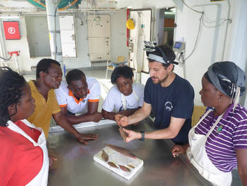
- Peter (blue shirt) giving a lesson on how to classify flatfishes

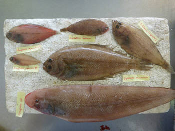
- The board used for species identification


- Samples of the spotted-fin rockfish (Scorpaena stephanica)

Fisheries research surveys are among the best examples of research activities related to the exploration and monitoring of marine biological diversity.
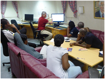
As taxonomist on board the Nansen Ghana survey, my role is to make sure that the species caught are correctly identified, try to identify new species, and provide “on the job” training for the local participants on species identification.
Here in the accompanying photo, you can see me carrying out a demonstration on the identification of flatfishes (Pleuronectiformes), which can be quite difficult to classify.
The local participants were guided through the identification process with a “special” tool specifically prepared for this purpose.
Such surveys are also unique opportunities to undertake field testing of new species identification guides, document geographical extensions of species and collect specimens belonging to “problematic taxa” for post survey analyses (i.e. taxa that are difficult to classify).
Catches of easily identifiable specimens such as the spotted-fin rockfish (Scorpaena stephanica) are often mixed with undescribed species that are collected for morphological and molecular analyses.
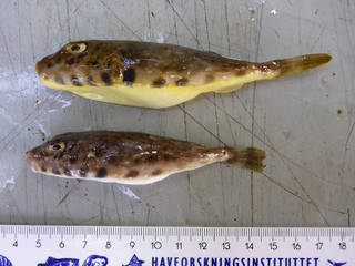
Some of our more interesting observations on the species are the color patterns of some fish, such as the imperial scaldfish (Arnoglossus imperialis) and the Guinean puffer (Sphoeroides marmoratus).
The color patterns of the imperial scaldfish clearly represent different sexes of the species, whereas the color patterns of the Guinean puffer needs further analysis in order to verify if the color differences represent different species.
Accurate information on the geographical distribution of species is an essential requirement for taxonomic studies and fisheries management.
As the RV Dr Fridtjof Nansen cruises through Ghanaian waters, some relevant catches from a faunistic stand point were made.
The wrasse, Coris atlantica, deserves a special mention as this species is presently known to occur only from Cape Verde to Liberia.
Finding this species in the Ghanaian waters represents the first documented record of this species in the Gulf of Guinea, thus confirming a southwards extension of its distribution range, as mentioned in the upcoming FAO species identification regional guide for the Eastern Central Atlantic.
- Samples of the Guinean puffer Sphoeroides marmoratus

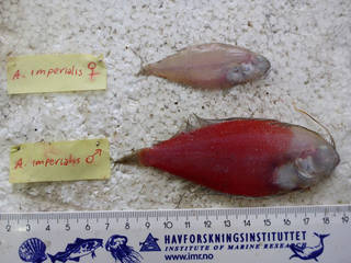
- Samples of the Arnoglossus imperialis

- Fabio giving a short demonstration of the use of GIS in the main office of the Nansen.

During our very limited free time we sometimes hold “scientific side events” where we present on important skills needed for the research.
Fabio held the first of such events and he gave a short lecture on the use of Geographic Information Systems (GIS) for the analysis of trawl data.
After dinner one evening, Fabio introduced the various methods for extracting geo-referenced data from the NANSIS database and importing this data into GIS (an open-sourced software).
A series of maps were shown, displaying the location of trawl stations, the amount of total catches and the species richness at each station. Participants were challenged to look for a qualitative assessment of habitat preferences for some group of species based on location and presence/absence.
If you have any questions, we’re on board and ready to answer you. Just write your query in the comment box below.
Stay tuned for the next blog!
Fabio & Peter and the whole Nansen team

- Male specimen of the wrasse (Coris atlantica)
