
Webinars
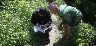
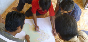
IFAD and FAO are offering an online learning programme to support development investment projects and partners in finding solutions to secure tenure rights through the combined application of participatory methods and geomatics technology.
The learning programme is accompanied by a series of short webinars where technology providers present their tools and software solutions for land recordation and give examples how they are applied in practice. Each webinar is around 30 minutes.

SOLA & Open Tenure | 1 July 2021 SOLA & Open Tenure are open-source software to help protect tenure rights and support the implementation of the Voluntary Guidelines on the Responsible Governance of Tenure of Land, Fisheries and Forests. These tools include solutions for land administration (SOLA) and community tenure recording (Open Tenure). Presenter: Maria Paola Rizzo, Land tenure officer and field geospatial data collection tool specialist at FAO |

Participatory mapping and innovative land portal in Indonesia | 7 October 2021 The Jaringan Kerja Pemetaan Partisipatif (JKPP), or the Indonesian Community Mapping Network, and its members have carried out participatory mapping covering a total area of 17.1 million hectares in Indonesia. The mapped areas are presented on a portal that brings together various GIS data sets, including 3,405 community-managed areas and 481 disputed areas. The network uses this to advocate for the recognition of indigenous and local communities' land. View recording | View presentation | Visit Land portal | View additional content |

Cadasta develops and promotes simple digital tools and technology to help to efficiently document, analyse, store, maintain and share critical land and resources rights information. Presenter: Frank Pichel, Co-founder and chief programs officer of Cadasta Foundation View recording | View presentation | View story map | Visit website |

Mobile Applications to Secure Tenure | 29 July 2021 USAID’s Mobile Applications to Secure Tenure (MAST) is a tool-agnostic approach that uses common land administration and resource management data standards and can be adapted by any development partners and stakeholders to test and scale new methods for participatory land and resources management. Presenter: Simon Norfolk, Director of Terra Firma |
Social Tenure Domain Model (STDM) | 9 September 2021 The Social Tenure Domain Model (STDM) is a pro-poor, participatory and affordable land information tool to represent people-to-land relationships along the ‘continuum of land rights’ frameworks. It is a system based on open and free software packages. It has been applied in both rural and urban areas in different contexts in various countries. Presenter: Danilo Antonio, programme management officer, UN-Habitat View recording | View presentation | Visit website | View videos |
Participatory mapping and innovative land portal in Indonesia | 7 October 2021 The Jaringan Kerja Pemetaan Partisipatif (JKPP), or the Indonesian Community Mapping Network, and its members have carried out participatory mapping covering a total area of 17.1 million hectares in Indonesia. The mapped areas are presented on a portal that brings together various GIS data sets, including 3,405 community-managed areas and 481 disputed areas. The network uses this to advocate for the recognition of indigenous and local communities' land. View recording | View presentation | Visit land portal | View additional content |