


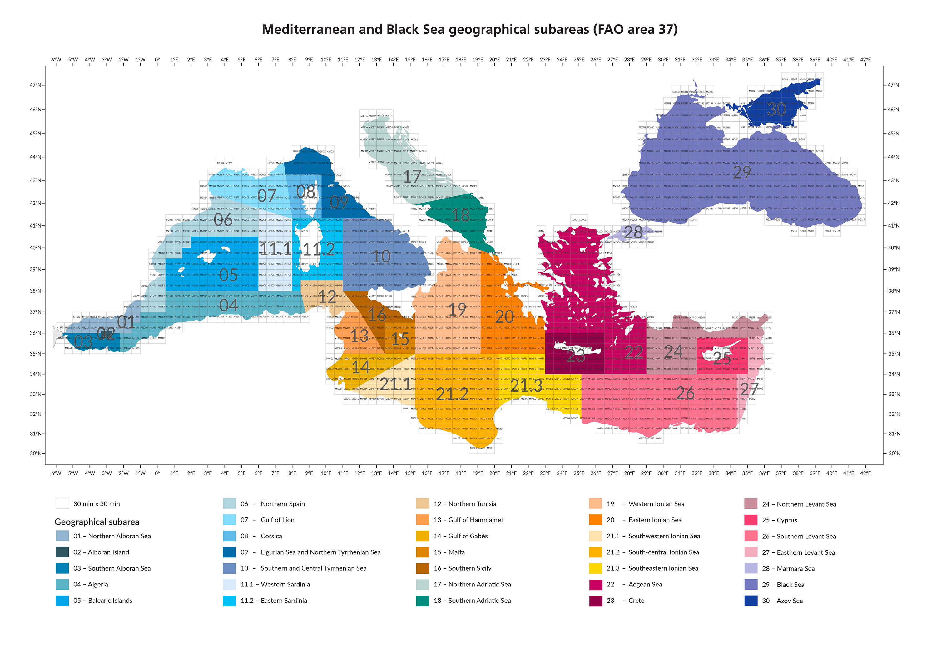
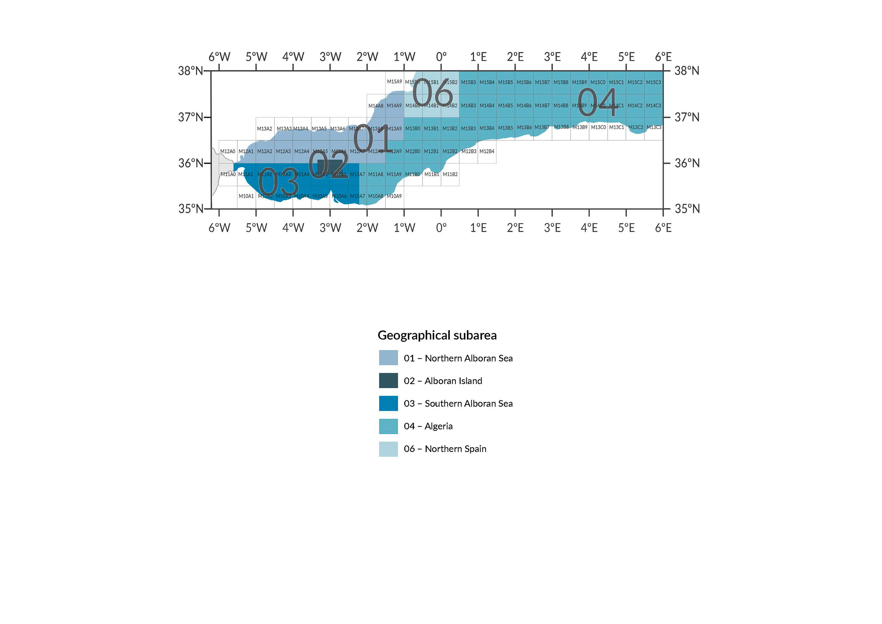
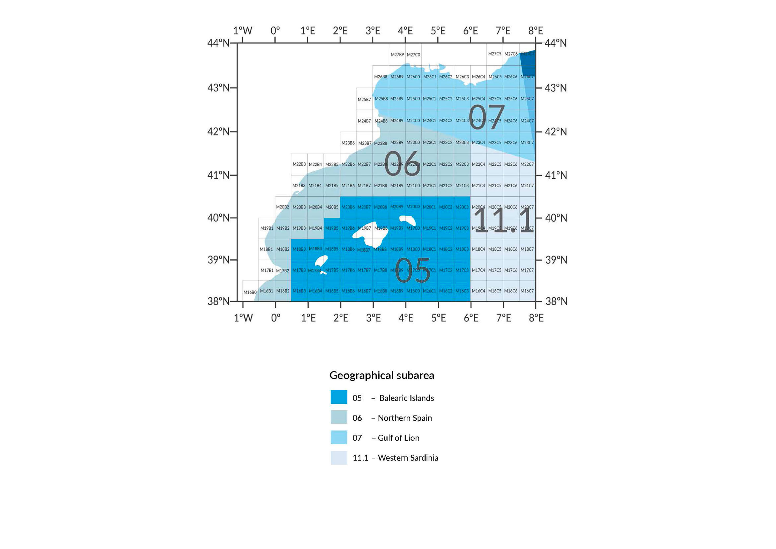
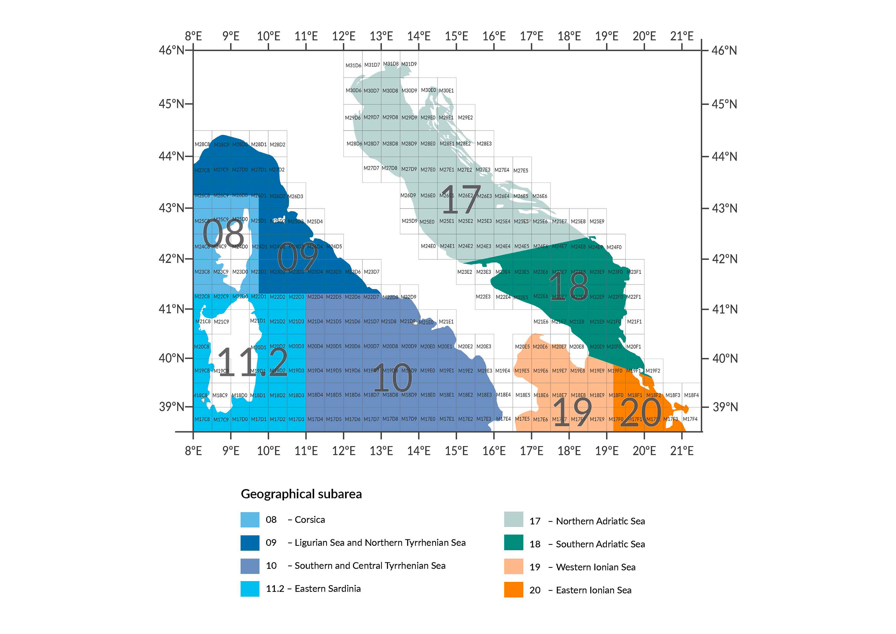
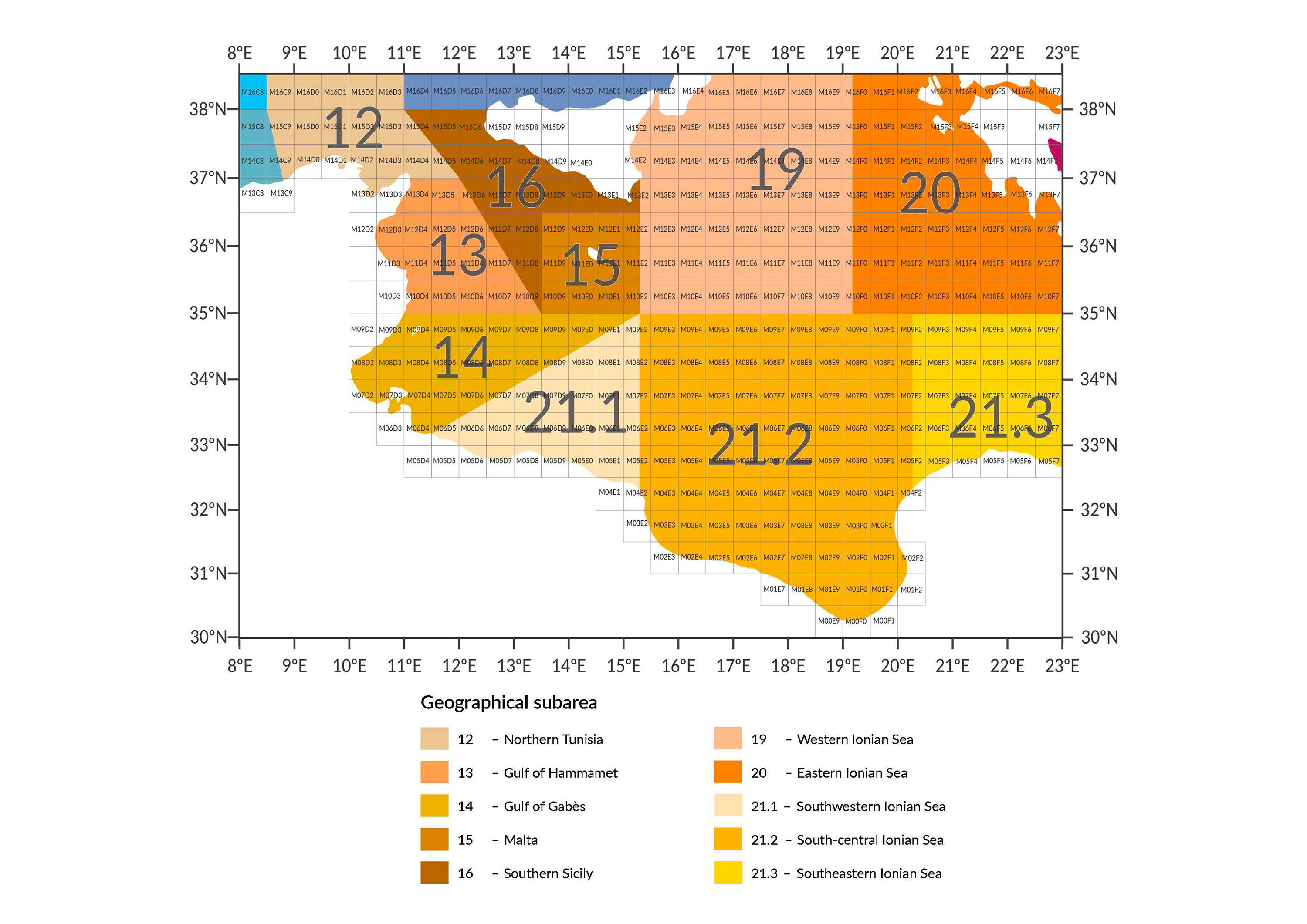
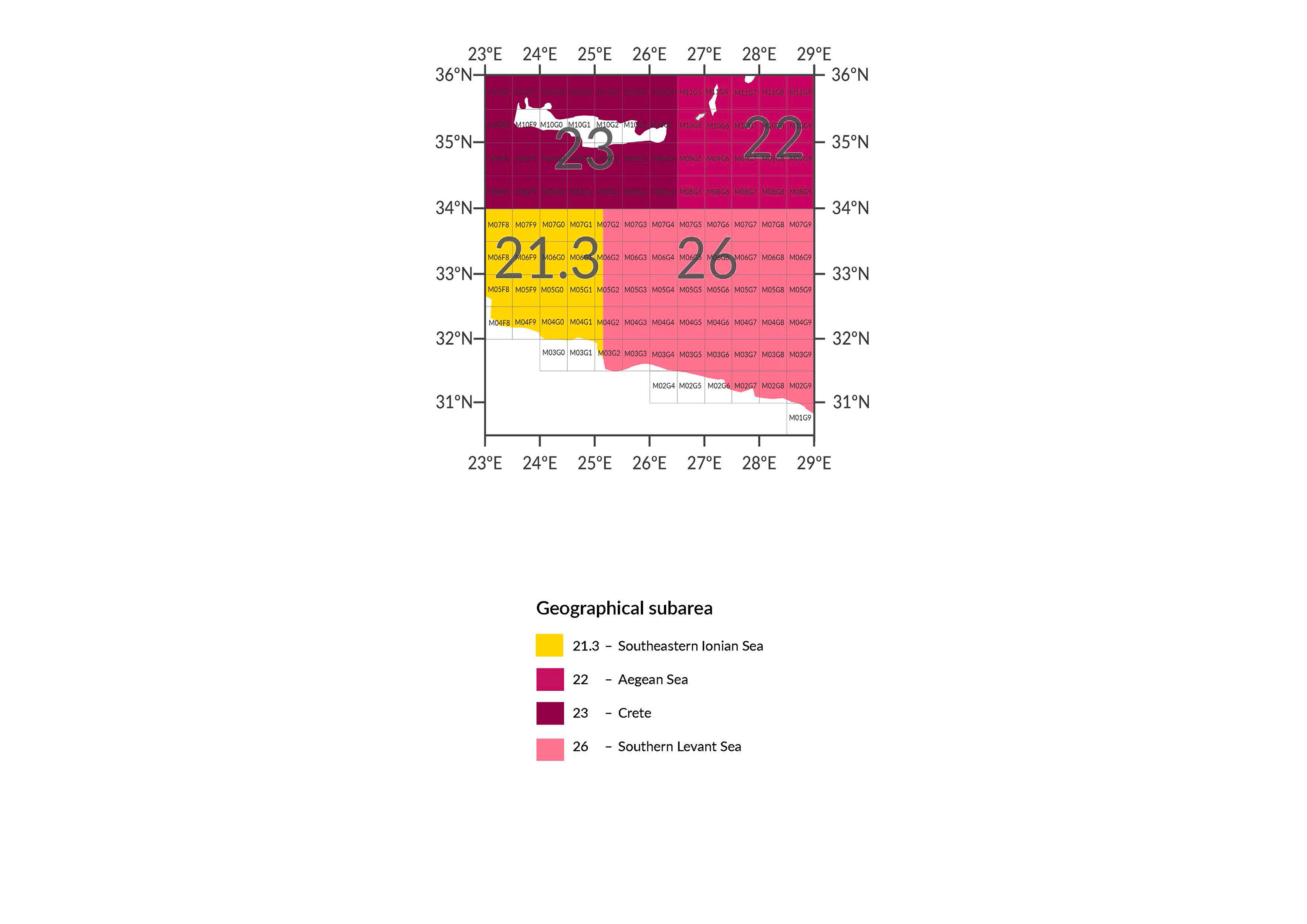
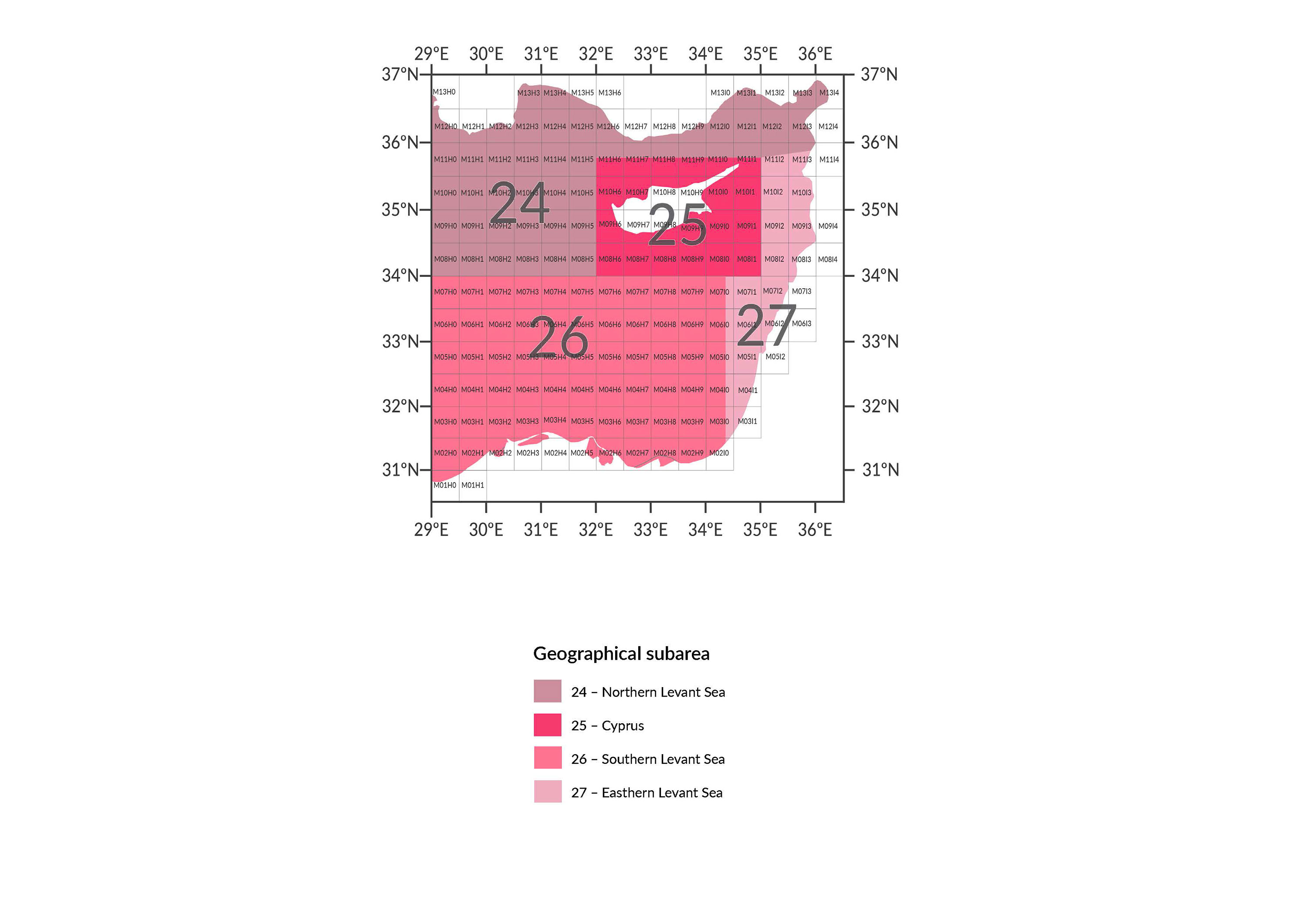
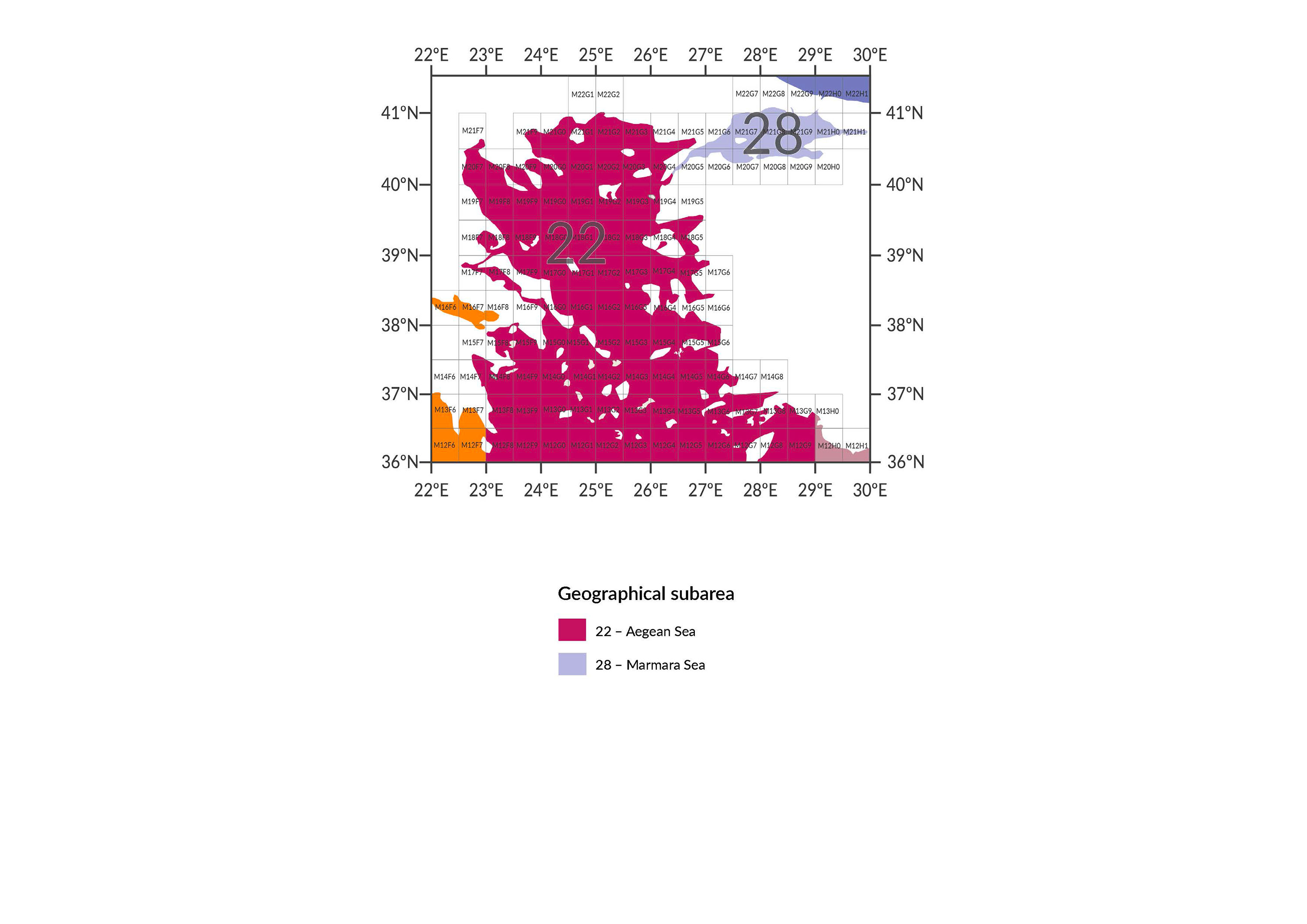
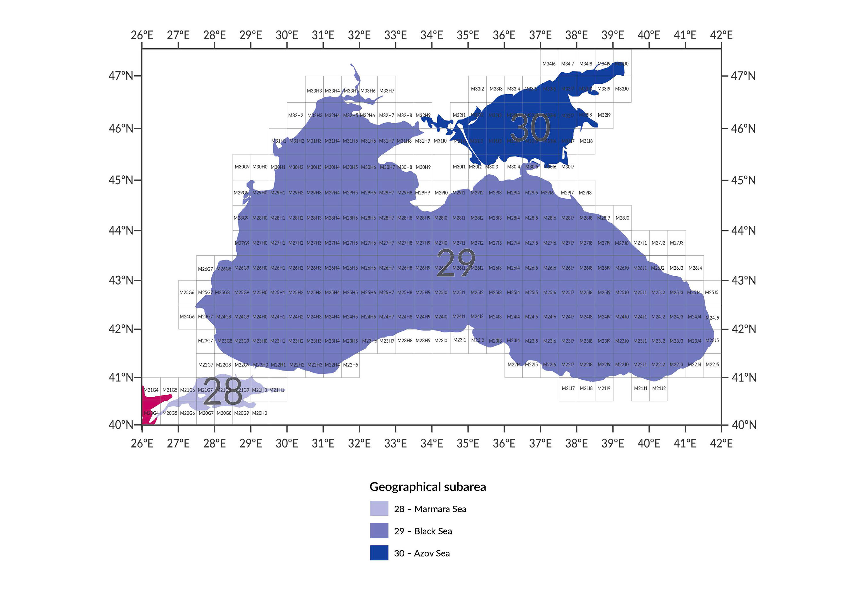
The FAO standardized geographical grid is used for spatial fisheries data reporting in the Mediterranean and Black Sea. It divides the region into uniform spatial cells, each identified by a unique code based on latitude and longitude. This system supports harmonized data collection, analysis, and mapping across CPCs, ensuring consistency and comparability of spatial fisheries information.
Digits for the codification of the rectangles in the statistical grid. The numbers of a rectangle in the GFCM statistical grid are a five-digit code:
- Latitude is covered by a three-digit code of a letter and two numbers, ranging from M00 (30°N) up to M34 (47°30'N)
- Longitude is covered by a two-digit code of a letter and a number. Letters run from A to J and numbers per letter run from 0 to 9, ranging from A0 (6°W) up to J5 (42°E)
Resources
